


1
2
3
4
5
6
7
8
9
10
11
12
13
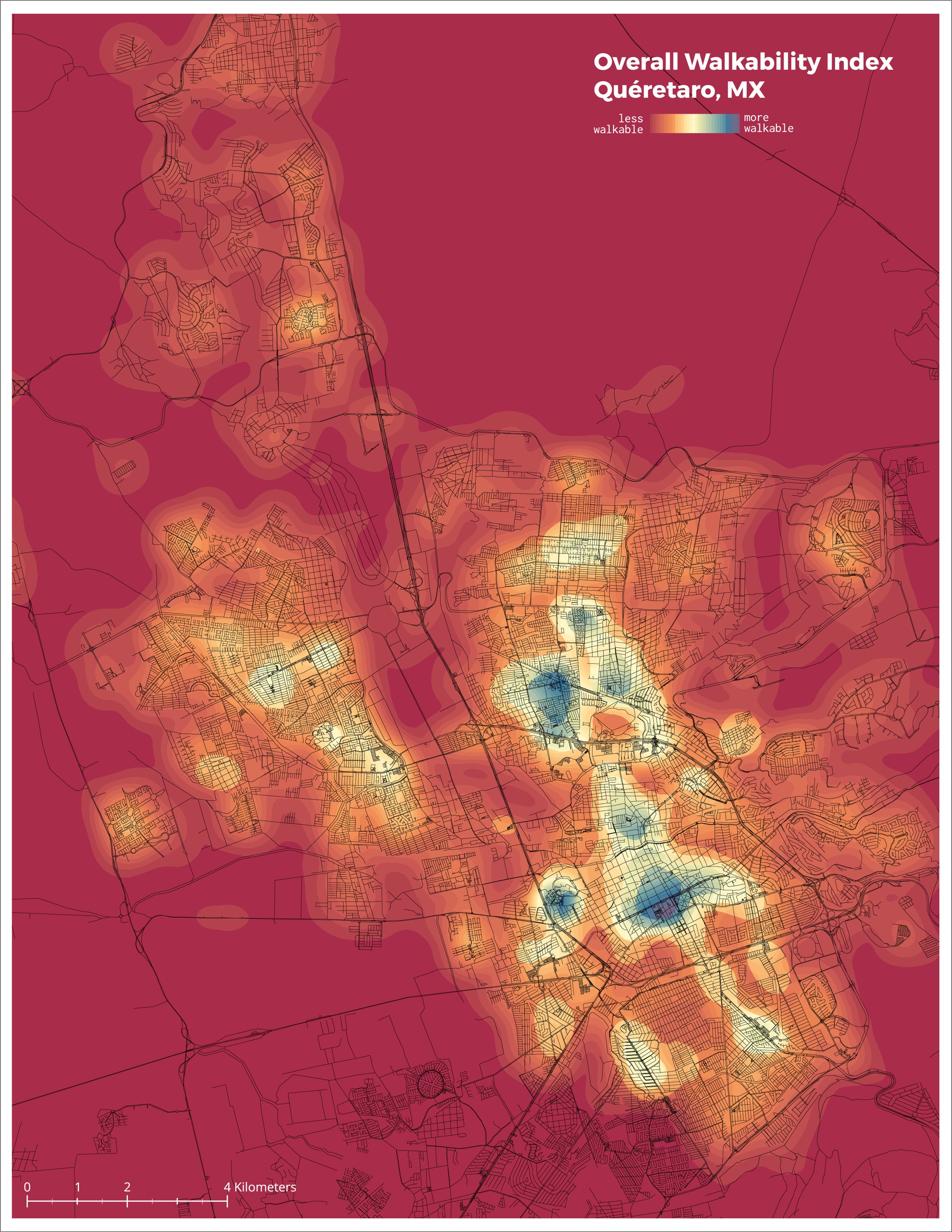
QRO Walkability Index (2017)
This map is part of a project undertaken in 2016 partnership with the municipal government of the city of Queretaro, Mexico. Queretaro's Secretary of Mobility sought to implement strategies to increase walking and cycling in the city. To this end, the Secretary partnered with the department of City Planning at the University of Pennsylvania School of Design to help develop a bicycle network plan using mobility research and analysis. during my time as a Graduate Student in City Planning at the University of Pennsylvania.
Road Network Walkability for Queretaro, MX
This map is part of a project undertaken in 2016 partnership with the municipal government of the city of Queretaro, Mexico. Queretaro's Secretary of Mobility sought to implement strategies to increase walking and cycling in the city. To this end, the Secretary partnered with the department of City Planning at the University of Pennsylvania School of Design to help develop a bicycle network plan using mobility research and analysis. during my time as a Graduate Student in City Planning at the University of Pennsylvania.
SEPTA Trails and Assets
This map was created as part of my time as a graduate intern in Long Range Planning at the Southeastern Pennsylvania Transportation Agency (SEPTA) in 2016 and 2017.
2017 CPLN - C3 Report - Overview Map.jpg
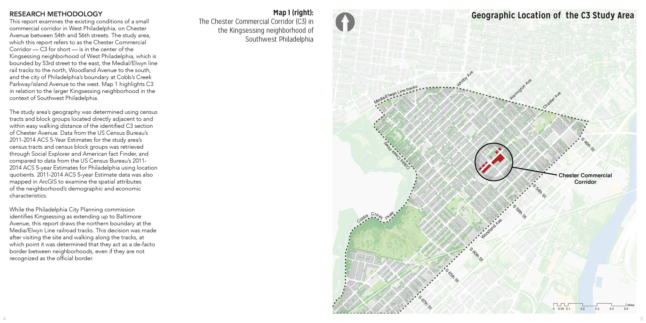
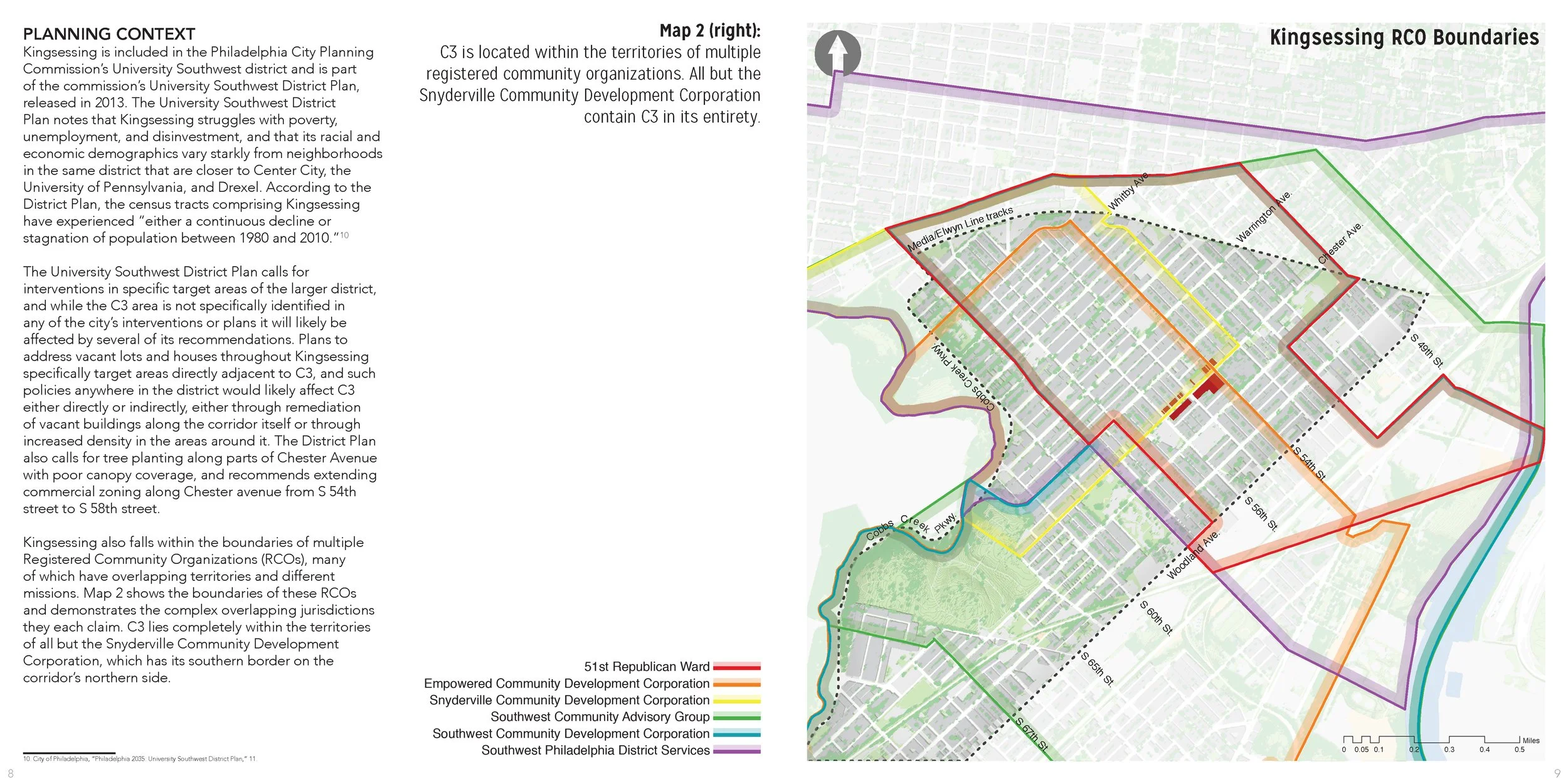
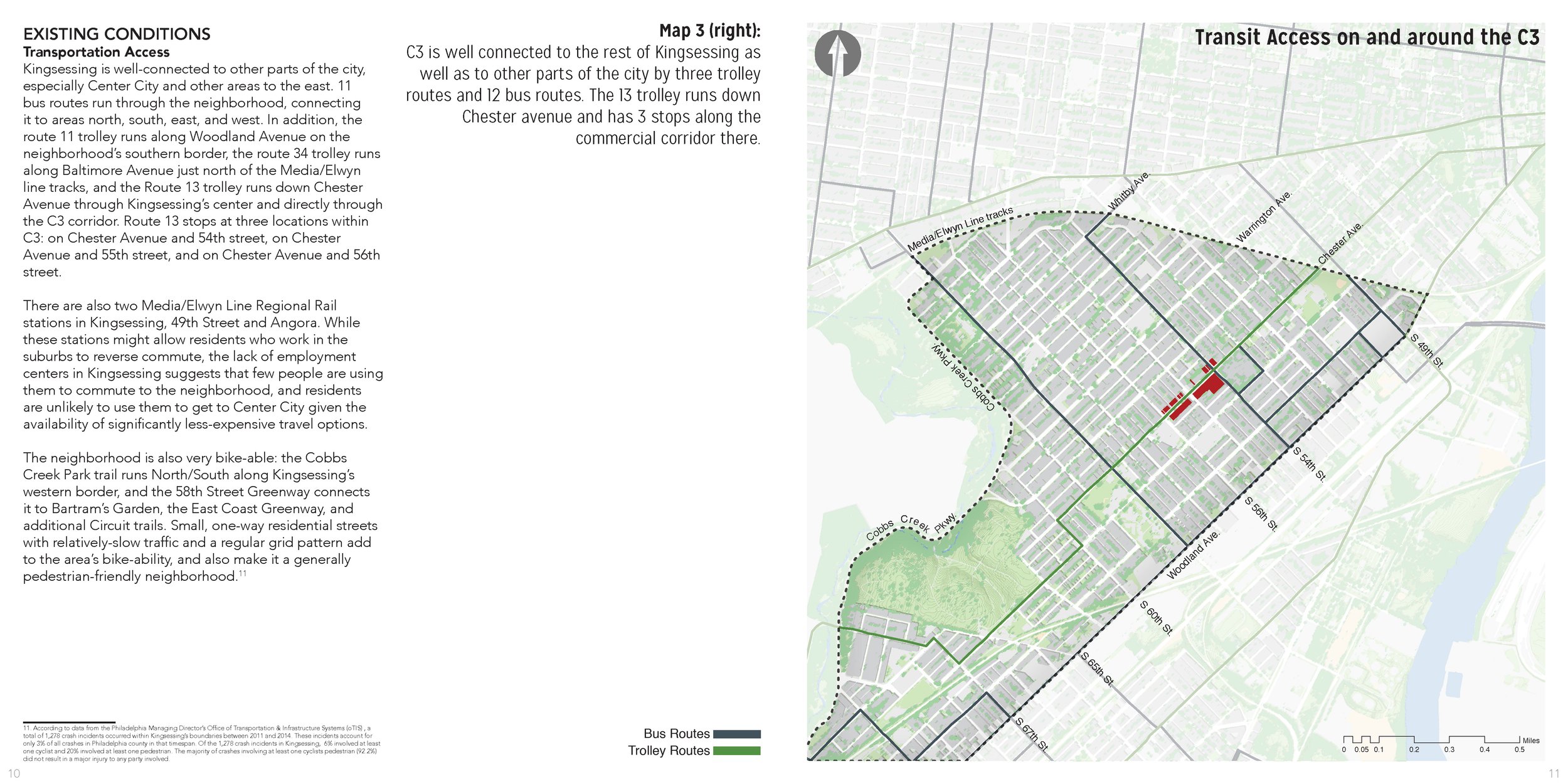
The text and map on this spread are from a peacemaking analysis report undertaken as part of my graduate studies at the University of Pennsylvania School of Design.
The report examined a small commercial corridor on Chester Avenue in West Philadelphia, positing strategies for future community and economic development revitalization.
The full report was published in the Panorama volume 25 (spring 2017), the annual student Journal for the University of Pennsylvania School of Design department of City and Regional Planning.
Raster GIS Exercise - siting a specific land use